

In this series, I’ll be using the power of Google Street View to show how twelve years can change the face of our urban cores. Street View allows us to look back in time, revealing our changing city landscapes as they evolve. We adapt to visual change in our environments so quickly that we forget what they used to look like in a few short years. GSV gives us a unique window into the changes in our urban cores.
I love to witness the power, beauty, nuance and heart of cities across the state, and across the country. The Urban Phoenix began when I decided to shine a spotlight on the good things happening in small cities with troubled perceptions and flawed reputations.
Before 2020, I would check out Google Street View before visiting a city for the first time in an effort to familiarize myself with the streetscape and layout, and maybe find a few visual points of interest. For the urban explorer, GSV can be an extremely valuable tool.
While Covid-19 has forced the nation to stay home, I am grateful I can still virtually travel to almost any community large or small across the country, and even the world. I’m not going to lie, I’ve done a solo virtual bar-hop in some of my favorite cities using Google Street View in the last year. Yeah, I know, 2020, am I right?
But the real power of Google Street View isn’t the ability to move through space, it’s the opportunity to walk through time. Never before have we had the chance to walk down a street and experience its recent history. We can look up, down, spin around, and pull back to see the construction of the shiny new skyscraper or zoom in to see where that old park bench used to be.
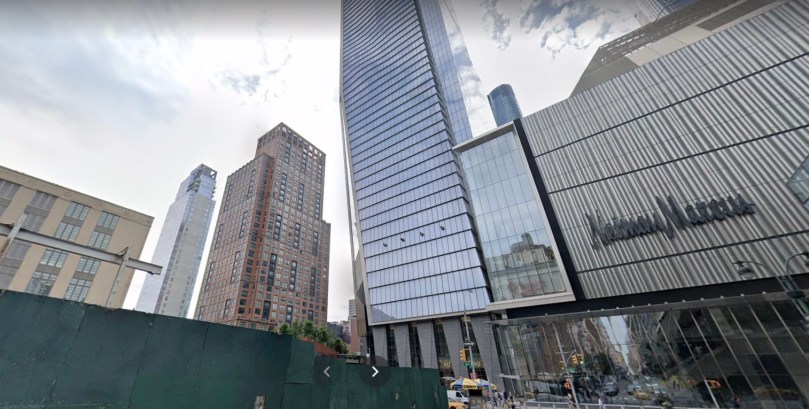
Big cities evolve very quickly, giving us the most dramatic examples of change. Few examples are more extreme than the swift construction around New York City’s High Line Park. This is the ultimate example of how human-scale greenspace can inspire unimaginable financial growth (which is often accompanied by subsequent gentrification). The GSV images below highlight just one example of the same place in 2009 and 2019.

But stepping back in time isn’t just for big cities… midsized cities like Rochester, New York can provide examples of astonishing change in the last 10-15 years. Regular followers know that I’m a huge fan of my home city’s decision to remove an aging, underused, moat-like downtown highway know as The Inner Loop. In just a few years, the sunken, circulator-style expressway’s east side was filled in, creating hundreds of thousands of developable, shovel-ready square footage. Today, apartments have been built or are currently under construction on top of what used to be crumbling pavement. The shocking transformation shown below takes place from 2007-2019. Even more progress has been made on this spot since.


2019


Ironically, GSV let’s us take a walk back in time when this space wasn’t walkable at all. Today, not only did slow streets, new sidewalks and a mile-long cycle track replace a failed freeway, all of these human-scale elements currently feed a growing neighborhood that literally didn’t exist 5 years ago. Furthermore, Rochester’s Strong Museum of Play, home of the Toy Hall Of Fame, is currently expanding into a large portion of the Inner Loop infill.
GSV shows us something else about the old Inner Loop Expressway… the lack of traffic.

Part of the reason Rochester filled in this section of highway was simply because it needed extensive rehabilitation, but lacked the usage to warrant the investment. Amazingly, filing in the space was far less costly than it would have been to bring the Inner Loop out of disrepair. GSV gives us a window into the stark lack of usage in 2007… of all the images I came across, there was only one frame showing a vehicle utilizing it.
And Rochester isn’t done… the Inner Loop North transformation project is already underway. And while the East section was the “easy” win, removing the North section of this urban highway is the biggest challenge. This is the part of the Inner Loop that was intentionally created to separate rich from poor, white from black. The Northern section of The Inner Loop may be one of the most powerful elements of racial exclusivity in a city that is as racially stratified as any in our country.
Google Street View gives us a front row seat to the transformation from one of Rochester’s greatest mistakes to one of our most promising victories. I would encourage you all to see this transformation for yourself by looking at Rochester’s Inner Loop infill. We did what so many mid-sized cities are still talking about, and I’m thrilled with our leadership for making this a reality.